tools
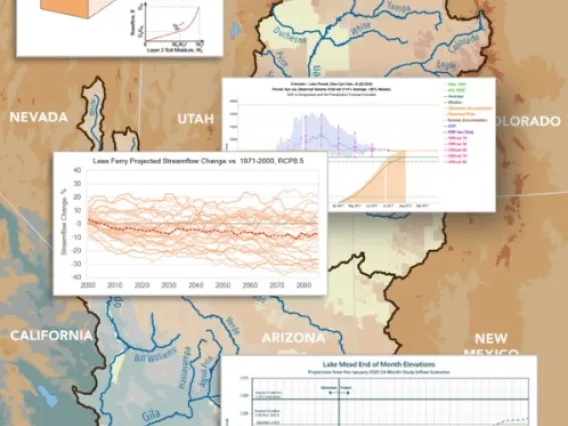
The Colorado River Science Wiki was created by SW CASC researchers and is now available for use by managers and other decision-makers, researchers, the media, and the broader public. The Wiki is a web-based platform with many goals, including helping to inform discussions about the next Interim Guidelines on the Colorado River. The site summarizes and shares the most recent Colorado River research, increases visibility of the activities of the research community, and makes accessible important datasets and tools. Additionally, it is a space where contributions can be made by the community and ownership is shared, and where advances in science are given context so they have more value to non-specialists. The Wiki was created with funding from the SW CASC.
Station Viewer is a web application by the Western Regional Climate Center and the Southwest Climate Adaptation Science Center that provides users with an interface for viewing station metadata and building station data products.
Users are able to select stations of interest by choosing station markers from a map or by using text search. Once stations are selected, metadata for each station, such as station name, county FIPS code, elevation, etc., can be quickly and easily viewed. After choosing a station, users can navigate to the station's dashboard where they are presented with a monthly climate summary of temperature and precipitation measurements for that station. Other period of record data products for the selected station, such as Monthly Summarized Data and General Climate Summary tables, can then be built and viewed on-the-fly.
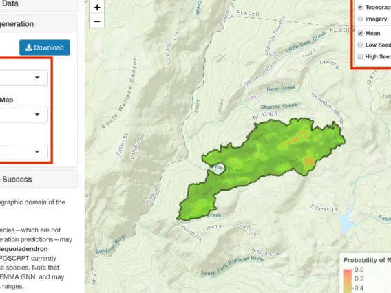
The Postfire Conifer Reforestation Planning Tool (PostCRPT) seeks to answer the questions of where conifers will regenerate on their own after wildfire and, conversely, where conifer reforestation efforts might be targeted. The app is designed to simplify the process of creating predictive maps of postfire conifer regeneration.
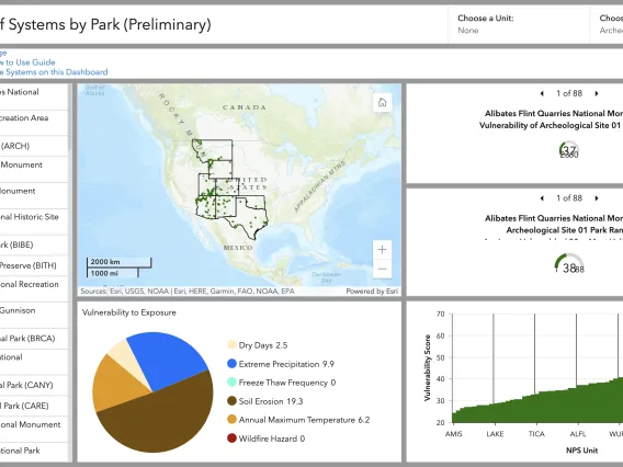
The Cultural Resources Environmental Vulnerability Assessment Toolbox (CREVAT) is a geospatial application that covers the entire NPS Intermountain Region and provides data on multiple environmental exposures. We also provide geospatial layers showing the vulnerability of resource types based on their sensitivity to a given exposure. We designed CREVAT as an entry point for park managers in assessing vulnerability and developing climate adaptation strategies, and who need a way to quickly and easily perform a general, evidence-based impact assessment of environmental factors on their cultural resources, that they can then examine further with site-specific information.